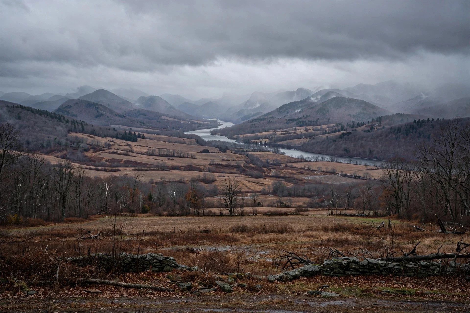
The Hudson Valley under a November sky.
By Mara Quinn | November 11, 2026
A coastal nor'easter will push up the Eastern Seaboard on Thursday, carrying heavy rain into the Hudson Valley through Friday morning and delivering the season's chilliest air yet in its wake. For valley residents planning around the next 72 hours, the essential question is not whether rain is coming but how much falls where, when it peaks, and whether cold air arrives in time to turn any of it white.
The short answer: plan for a thorough soaking Thursday night, a raw and grey Friday, and a cold but mostly dry weekend. Snow belongs to the mountains.
Rain Timeline: Thursday Afternoon Through Friday Morning
Rain reaches the New York City area as early as Thursday afternoon, according to reporting by the New York Post. The heaviest and most sustained rainfall falls late Thursday into Friday morning. For Kingston, weather data from Weather.com as of November 11 shows Thursday delivering just over an inch of rain across the day and overnight combined. The daytime period carries a 100 percent precipitation chance with 0.60 inches expected, and an additional 0.44 inches follows through Thursday night, pushing the overnight low to 37 degrees.
Compare those numbers with what Veterans Day looked like. National Weather Service data reported by RFTUV on November 11 showed Poughkeepsie reaching a high of 60 degrees with a low of 38 that morning, Beacon hitting 59 and 42, and Clinton Corners touching 56 and 38. The region spends Tuesday relatively mild and partly cloudy. By Thursday evening it looks like a different season entirely.
Kingston's daytime high on Thursday drops to 47 degrees. Friday stays raw, with an 80 percent chance of lingering rain and a high of only 42. National Weather Service forecasts for New York City showed Thursday highs near 59 and a low of 45 Thursday night, then 47 on Friday, as the Democrat and Chronicle reported on November 10. That is a 12-degree drop in daytime highs over a single day.
Friday's rain eases as the storm moves northeast. Kingston's Friday total is forecast at 0.19 inches, lighter than Thursday but still persistent enough to keep roads wet and skies grey through much of the day. By Friday afternoon the worst of it is done.
What Kind of Storm This Is
AccuWeather senior meteorologist Carl Erickson offered the clearest summary of the storm's character when speaking with the New York Post on November 10. "It looks like this will be primarily a rainmaker for much of the Northeast," he said. That assessment holds for the lower Hudson Valley, where temperatures through the core of the storm stay well above freezing at the surface.
Wet snowflakes may mix in across the Hudson Valley, Erickson noted, but meaningful accumulation requires elevation. Snow of note is expected only above 1,800 to 2,000 feet, in the higher terrain of the Adirondacks and Catskills. For the valley floor from Yonkers north through Poughkeepsie, Kingston, and beyond, rain runs the whole show.
National Weather Service data reported by the Democrat and Chronicle on November 10 showed no expected accumulation through 72 hours for Binghamton, Ithaca, Auburn, Cortland, and Cooperstown. Those communities sit at elevations broadly comparable to, or higher than, much of the Hudson Valley floor, and the forecast gave them nothing to shovel. The valley floor should expect the same.
The storm begins as rain Thursday and transitions toward a colder, snowier pattern as colder air moves in later Friday and over the weekend, the Democrat and Chronicle reported. Friday through Sunday is the primary watch period for central New York. But the threshold for significant snow at lower elevations remains steep.
The Mountain Difference: Catskills and Adirondacks
Higher terrain is where the forecast gets more interesting. The Democrat and Chronicle reported that colder and higher-elevation areas carry better odds of meaningful snow, with conditions ultimately depending on how far south and east cold air pushes before the storm exits. Early-season systems tend to favor snow in terrain farther from the warm Atlantic, where lower elevations and maritime air keep surface temperatures stubbornly mild, as Hudson Valley Country noted in its November 8 coverage.
First Due Weather, an Orange County forecasting service, flagged this storm as early as November 8. At that point both the American GFS and European models showed a coastal storm developing Friday, November 13, into Saturday, November 14, as Hudson Valley Country reported. Ben Noll, a prominent regional forecaster, described snow as a possible scenario but assigned it low odds in the Thursday-through-Saturday window, according to that same coverage.
For anyone hiking, camping, or driving into the higher Catskills or Adirondacks this weekend, that low-odds possibility is worth taking seriously before departure. Travel above 2,000 feet late Friday through Saturday should account for some snow on roads and trails. The valley floor watches; the peaks accumulate.
The Weekend Cold Behind the Storm
The storm itself is only part of the story. What follows it may matter just as much for anyone with outdoor plans.
Erickson told the New York Post that the system "will bring some of the chilliest air so far this season behind the storm." Gusty northwest winds follow as the storm clears, pushing temperatures sharply lower. Overnight lows in the mid to high 30s are forecast for the city and suburbs on both Friday and Saturday nights, the Post reported.
Kingston data from Weather.com showed Friday's low falling to 34 degrees and Saturday remaining at 34 overnight, with a Saturday daytime high of only 45. Sunday improves, climbing to 50 under partly cloudy skies.
For the Hudson Valley, the practical effect is a weekend that opens wet and raw on Friday, then turns mostly cloudy and cold by Saturday. Gardens planted late, outdoor events, and Saturday morning farmers markets all face that northwest wind. At 34 degrees overnight in Kingston, frost is a real consideration at the lower elevations. It is not a question of whether conditions approach frost territory but of how exposed any given surface turns out to be.
The Dutchess County area had no active National Weather Service alerts as of November 11, as RFTUV reported. That does not change the case for dressing in layers or protecting sensitive plants through the coldest overnight hours.
What RFTUV Watched Last Weekend
RFTUV covered the season's first-snow watch on November 9 and 10 as models began locking onto this system. At that point, the question was whether a coastal low could organize enough to threaten meaningful accumulation in the lower valley. As the storm approached and guidance sharpened, that question resolved firmly toward rain for the valley floor.
That progression is familiar in early-season forecasting. Cold air often struggles to push far enough south and east before a nor'easter arrives. The warm Atlantic tempers temperatures near the coast and keeps precipitation liquid through the heaviest bands. The mountains collect snow because they reach into the colder atmosphere above that maritime influence. The valley waits.
How This Storm Fits the Winter Outlook
This nor'easter did not arrive without a larger context. Ben Noll published a Hudson Valley winter outlook in October 2026 that placed storms exactly like this one squarely in the forecast for the months ahead.
Noll's outlook pointed to a record El Nino event coinciding with this winter. His analysis of climate models showed roughly twice as many strong storms near the East Coast as normal, with 18 predicted against the typical 9. He described the season ahead as more likely to be notably rainy and perhaps windy, with elevated humidity persisting through the winter months. Around 35 to 40 wet days are possible from November through March, some carrying flood risk.
Critically, Noll said a repeat of last winter's persistent cold was very unlikely. Cold snaps, he wrote, would more probably arrive as brief episodes rather than sustained stretches. For Hudson Valley residents bracing for another winter of deep freezes, that is meaningful context. The season Noll described looked less like a classic snowbelt winter and more like a parade of storms that arrive hard, deliver rain, and move on before the air can lock in and stay.
This nor'easter tracks that description closely. It brings rain, not major snow, to the valley floor. Cold air follows but does not anchor. Kingston's Sunday high recovers to 50 degrees after the Friday low of 42. That is fleeting cold in practice, not the kind of cold that reshapes a week.
Noll also noted that a below-average snowfall signal through November and December fades as the new year begins. Snow becomes more competitive in January and beyond, even during an El Nino winter. The patience required right now, in mid-November, is part of the outlook.
Planning Around the Next Four Days
For most of the Hudson Valley, the planning picture is straightforward. Rain begins Thursday afternoon and runs through Friday, with the heaviest totals arriving Thursday night. Thursday evening plans are worth moving indoors or making flexible. Friday morning travel will be wet, and northwest winds pick up as the storm exits, adding to the chill.
By Friday afternoon the rain eases. By Saturday the precipitation stops and the cold settles in firmly, with mostly cloudy skies and a high near 45 in Kingston. Sunday offers the best conditions of the stretch, partly cloudy and recovering to 50.
The Kingston forecast arc captures the week's shape: Wednesday high of 61, Thursday dropping to 47 with heavy rain, Friday raw at 42, Saturday mostly cloudy and cold at 45, Sunday recovering to 50 under partial sun. That is four days of active, shifting weather followed by a brief window of quiet before the next system cycles through.
Ben Noll's winter outlook suggests those cycles will continue at roughly twice the normal frequency. Kingston will collect just over an inch of rain by Friday morning. The Catskill peaks will collect some snow. The valley floor stays wet, then cold, then briefly quiet.
The season is just beginning.
Sources
- New York Post, November 10, 2026
- Democrat and Chronicle, November 10, 2026
- National Weather Service via RFTUV government digest, November 11, 2026
- Weather.com Kingston ten-day forecast, November 11, 2026
- Hudson Valley Country, November 8, 2026
- Ben Noll, Hudson Valley winter outlook, October 2026