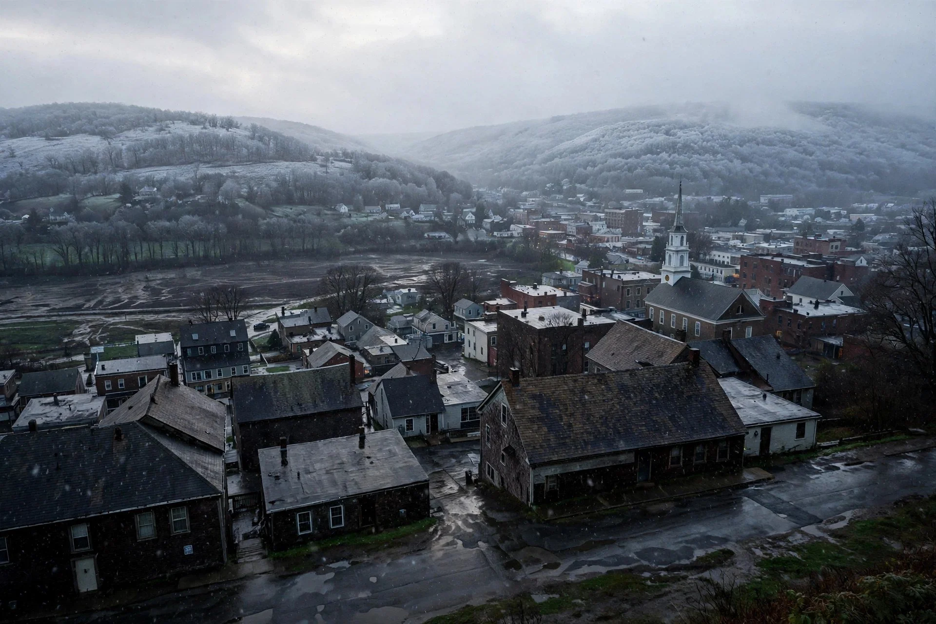
Snow on the hills, rain in the valleys.
By Mara Quinn | November 13, 2026
Winter Weather Advisory Now in Effect for High Elevations
The National Weather Service issued the region's first Winter Weather Advisory of the season Thursday. It covers elevations above 1,500 feet in western Greene and western Ulster counties. The advisory runs from Thursday at 7 p.m. through Friday at 1 p.m. The National Weather Service, reported by 943 Lite FM, expects 2 to 5 inches of wet snow across the advisory area.
This is the follow-up to RFTUV's First Snow Watch coverage from November 10. That report tracked a rain-dominant week with a possible rain-to-snow changeover near Friday, with higher elevations carrying the best odds. The advisory confirms that call.
Why Your Elevation Determines What You Get
The split between mountain snow and valley rain comes down to temperature at altitude. Meteorologist Ben Noll explained Thursday that air at 5,000 feet chills below freezing by early Friday. That cold layer aloft allows wet snowflakes to mix with rain, especially at higher elevations. Surface temperatures in the valley stay in the mid-30s. The ground holds warmth from recent weeks. Snow will not stick to pavement there, Noll said.
Communities in western Ulster and the Sullivan mountain terrain sit closer to freezing than the valley floor. Some wet snow accumulation is likely in those areas. Temperatures across the region rise to the low 40s by Friday afternoon, closing the snow window quickly.
A coastal storm drives the event. The storm pulls colder air south from Canada as it tracks up the coast Thursday. Rain develops across the broader region Thursday as the system moves in. The cold air at altitude arrives in time for early Friday, giving the mountains their snow opportunity before afternoon warming cuts it off.
What the Advisory Area Includes
The National Weather Service advisory, as reported by 943 Lite FM, targets western Greene and western Ulster counties above 1,500 feet. That takes in the higher Catskill terrain in those two counties. The advisory window is Thursday 7 p.m. to Friday 1 p.m. Residents and drivers in those elevations should expect 2 to 5 inches of heavy, wet snow.
The National Weather Service issued a separate advisory for Hamilton County, northern Warren County, and Essex County. That advisory runs Thursday at 10 a.m. through Friday at 10 a.m., also for land above 1,500 feet. Accumulations there run 2 to 3 inches, with 3 to 5 inches on the highest peaks. Valley locations are not included in either advisory.
Dutchess County Stays Wet
No active weather alerts are in place for Dutchess County. The National Weather Service, via the county digest, forecasts rain-snow conditions Friday but with surface temperatures too warm for accumulation. Clinton Corners is expected to reach 39 degrees Friday with rain-snow mix. Poughkeepsie comes in at 42 degrees with rain-snow conditions. Beacon sits at 41 degrees with light rain. At those temperatures, any snowflakes that fall mix with rain and do not accumulate on roads or sidewalks.
Kingston, in Ulster County, falls closer to the advisory boundary but still below it. Weather.com forecasts snow showers for Kingston Friday morning, a high of 41 degrees, and a 60 percent chance of precipitation. That is valley-floor Kingston. Residents may see mixed precipitation Friday morning but should not plan for significant accumulation.
Friday Morning Commute: Risk at Elevation, Wet Roads Below
The National Weather Service warned of slippery travel conditions in the advisory area during the Friday morning commute. That risk applies to mountain roads in western Greene and western Ulster, not the valley floor. Drivers who travel through or to those elevations on Friday morning face the greatest exposure. Plan for reduced traction and limited visibility in advisory zones.
For the broader mid-Hudson Valley, Ben Noll said mid-30s surface temperatures will keep roads wet rather than icy. The risk is caution, not crisis, for valley-floor commuters.
A Cold Weekend, Then Warmth Returns
After Friday's system clears, a chilly weekend follows. Ben Noll said a chilly weekend is expected once the storm exits. Kingston's forecast from Weather.com shows Saturday mostly cloudy at 47 degrees, then mostly sunny Sunday at 49 degrees. Conditions improve from there.
Next week brings steady warming. Kingston climbs to 53 degrees Monday, 56 degrees Tuesday, and 61 degrees Wednesday, according to Weather.com. Drier conditions accompany the warm-up. The region gets its first real look at winter Friday morning in the mountains, then returns to fall-like temperatures by the middle of next week.