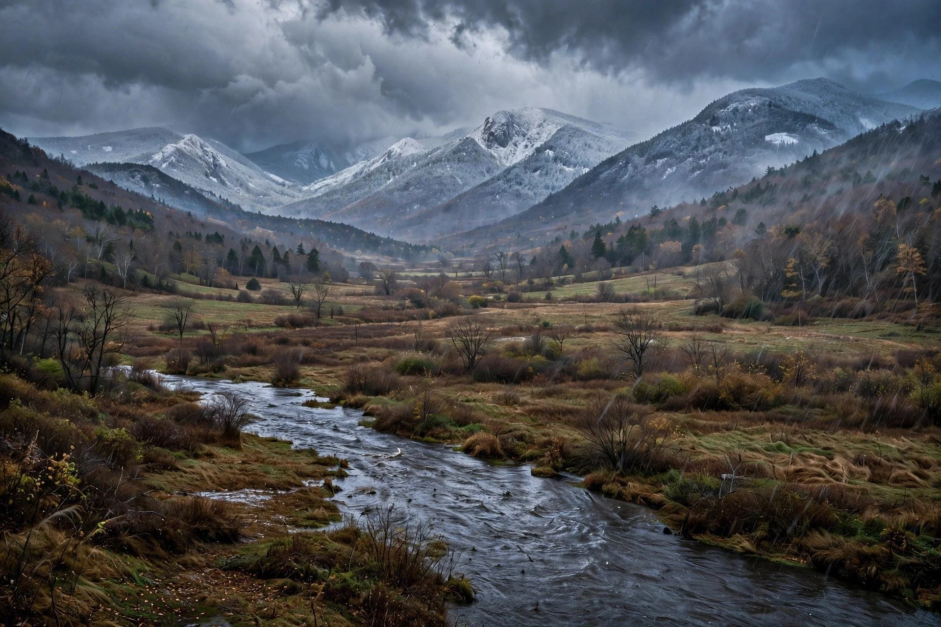
Rain in the valley, snow on the high peaks.
By Mara Quinn | November 12, 2026
The storm arriving Thursday does not treat the Hudson Valley as one place. Below roughly 1,500 feet, across the river corridor and the valley floor, this is a rain event: persistent, raw, running through Friday afternoon. Above that elevation, in the high terrain of the western Catskills, the same storm delivers snow. Hudson Valley Country put the probability of two or more inches accumulating in higher terrain at 60 to 70 percent. Some peaks reach several inches of heavy, wet accumulation by Friday morning.
Altitude draws the line. Everything in this forecast follows from that.
One Low, Two Outcomes
The low pressure center tracks east out of the Ohio Valley. It passes near or just south of the Hudson Valley on Thursday afternoon and night. After that, it stalls offshore on Friday, keeping the moisture tap open, then finally pulls toward the Canadian Maritimes Friday night into Saturday.
That prolonged offshore position is the mechanical core of this storm. It extends precipitation well beyond a single rain band. It gives the mountains time to accumulate significant snow once cold air settles into higher terrain Thursday night. For the valley floor, it means roughly 36 hours of rain rather than a brief wet afternoon.
Lohud reported Wednesday night as the start of rain development, with precipitation becoming widespread Thursday and the wettest period running Thursday afternoon through Friday afternoon. NWS does not expect rainfall to cause significant flooding in the valley. Minor coastal flooding remains possible Thursday through Friday, per Lohud.
AccuWeather senior meteorologist Carl Erickson called the system primarily a rainmaker for much of the Northeast, speaking to the NY Post on November 10. For the Hudson Valley floor, that description holds. For the high terrain of western Ulster County, it does not.
The Hour-by-Hour: Wednesday Night Through Friday Afternoon
Rain arrives quietly Wednesday night. Overnight temperatures across Dutchess County sit in the low 40s. Clinton Corners forecasts an overnight low of 40 degrees with rain likely. Poughkeepsie sits at 41 degrees overnight. Beacon at 45 degrees. Those figures come from NWS data in RFTUV's Wednesday morning government digest.
Thursday morning, the rain spreads. Light precipitation covers the valley through the early hours. The heavier rain holds off until afternoon, when the low tracks closer and the pressure gradient tightens.
By Thursday afternoon, rain turns widespread on the valley floor. That is also when the mountains begin to change. The Democrat and Chronicle reported that heavy wet snow becomes possible in the eastern Catskills and southern Adirondacks late Thursday afternoon, with that window extending into Friday morning. The snow starts at the highest peaks and works its way down through the evening.
Thursday night, the low passes near or just south of the region. Valley rain stays steady. At elevations above 1,500 feet in the Catskills, the precipitation transitions from rain to wet snow. Early accumulation stays light. The ground, still warm from fall, melts incoming flakes quickly.
The coastal low develops offshore and holds there into Friday. The moisture tap stays open. Valley rain continues. In the mountains, snowfall rates increase through the night as cold air settles and ground temperatures fall.
Friday morning marks the clearest separation between the two forecasts. Ben Noll, writing at 2:44 AM Wednesday, noted that mid-Hudson Valley residents see their first snowflakes early Friday, as air at around 5,000 feet chills below freezing. Valley-floor flakes mix briefly into the rain. At the peaks, Friday morning represents the heaviest accumulation period of the event.
By Friday afternoon, conditions begin to ease at lower elevations first, then gradually in the mountains as the offshore low finally tracks northeast.
Why Valley Pavement Stays Clear
Surface temperatures across the valley hold in the mid-30s through the event. The ground itself stays warmer, retaining heat absorbed over fall. Those two factors together explain why the valley floor stays rain throughout, even as snowflakes are technically falling through the air Friday morning.
Noll explained the mechanism. Air at around 5,000 feet chills below freezing by early Friday. Snow forms at that altitude. Those flakes descend through warmer air below and melt before reaching the surface. What lands on pavement is rain.
Above 1,500 feet in the Catskills, the air column stays cold enough top to bottom. Flakes survive the descent. They land as wet, heavy snow.
Erickson told the NY Post that snowfall of note stays confined to elevations above roughly 1,800 to 2,000 feet. Hudson Valley Country cited a mix-in threshold around 1,500 feet, with meaningful accumulation above that level. The difference between those two figures reflects genuine uncertainty in where the transition zone sits on this particular storm track.
The wetness of the accumulating snow matters for how it builds. Dense, wet snow sticks readily to tree limbs and power lines. It also compacts quickly once it lands. Early snow falling on warm mountain ground Thursday afternoon melts fast. The accumulation that counts arrives Friday morning, after the ground has cooled enough to stop absorbing what falls.
Dutchess County: 36 Hours of Rain, Then First Flakes at Dawn
Thursday's specific forecast for Dutchess County towns: Poughkeepsie at 52 degrees with light rain; Beacon at 53 degrees, light rain; Clinton Corners at 48 degrees, light rain. No Dutchess County alerts were active as of Wednesday morning's RFTUV government digest.
The valley experience is a straight rain event. Hudson Valley Country put total rainfall for the valley at 0.75 to 1.5 inches. NWS did not expect significant flooding. Drainage systems may be stressed over three-plus days of persistent rain, but road flooding is not the primary concern for Dutchess County residents.
Noll wrote that surface temperatures hold in the mid-30s throughout, with the warmer ground underneath probably preventing snow from sticking to pavement. Friday highs reach the low 40s.
The one meteorological development of note for valley residents comes Friday morning. First snowflakes mix into the rain as the upper atmosphere chills below freezing. Flakes hit warmer pavement and disappear. For most of Dutchess County, this is a brief visual interlude, nothing that changes the morning commute or requires a school delay.
AccuWeather noted that wet snowflakes mix in across the Hudson Valley, with snowfall of note contained to higher elevations. That aligns with what Noll described for the mid-Hudson. For context farther south: southern Westchester sees rain Thursday night and Friday, with lows in the upper 30s and highs in the mid-40s Friday, according to Lohud.
Western Ulster: Advisory in Effect, Mountain Roads at Risk Friday Morning
Western Ulster County is under a winter weather advisory. That separates it from every county below 1,500 feet in this event.
Hudson Valley Country put the probability of two or more inches in higher terrain at 60 to 70 percent, with some peaks reaching several inches of total accumulation. The Democrat and Chronicle reported that the probability of more than four inches rose to 50 to 70 percent in the eastern Catskills and southern Adirondacks, with heavy wet snow possible late Thursday afternoon into Friday morning.
Noll wrote that some Friday morning delays in western Ulster cannot be ruled out. Mountain roads that absorb wet snow accumulation through the overnight hours and into the morning rush face the clearest risk.
The mountain timeline: snow mixes in at the highest elevations Thursday afternoon as the storm deepens and colder air drains into higher terrain. The transition from rain to snow accelerates Thursday night. The heaviest accumulation arrives Friday morning during peak snowfall, as cold air fully settles and the offshore low keeps moisture flowing. By Friday afternoon, as the storm pulls northeast, mountain snowfall eases.
NWS Albany expects a greater chance of accumulating snow in higher terrain including parts of the Catskills, adding institutional weight to the private forecast guidance already pointing toward advisory-level totals. The storm asks western Ulster residents for preparation, not just attention.
Euro vs. GFS: What the Track Disagreement Means in Practice
The European model and the GFS agree on the core picture. Rain in the valleys, snow in the mountains, moisture starting Wednesday night and running through Friday afternoon. The disagreement is over the precise position of the coastal low as it settles offshore Friday, and specifically how much it may wrap precipitation back into the region.
That track difference carries real consequences for elevation-sensitive areas. Hudson Valley Country reported that small differences in storm position shift the rain-snow line. A low sitting farther north pulls colder air south, drops the snow line, and raises mountain totals. A low farther south keeps cold air confined and reduces mountain accumulation.
Both models keep the valley floor in rain. Both land the high Catskill peaks in snow. The genuine uncertainty sits in the middle elevations, roughly 1,000 to 1,500 feet, where the rain-snow line hovers depending on which solution verifies.
The 60 to 70 percent probability that Hudson Valley Country cited for mountain accumulation already accounts for that model spread. It is not a best-case estimate; it reflects the range of outcomes across both model solutions. The uncertainty is baked in.
For valley residents, the model disagreement changes nothing practically. For anyone with Friday morning travel through western Ulster or into high Catskill terrain, conditions may run better or worse than the advisory suggests, depending on the coastal low's final position.
Sunday: The Storm Moves Out
The low tracks toward the Canadian Maritimes Friday night into Saturday. Hudson Valley Country reported that conditions improve Sunday.
For the valley floor, the recovery is clean. Rain ends by Friday afternoon or evening. Temperatures hold in the low to mid-40s through the weekend. Saturated ground drains over the days following. No ice, no residual snow at lower elevations.
In the mountains, Sunday brings a first look at what accumulated. At the highest Catskill peaks, several inches of wet, dense snow will be on the ground, now settling and compacting as temperatures moderate into the 40s. That type of wet snow melts relatively quickly once temperatures recover, and significant settling begins by Sunday afternoon.
For Poughkeepsie, Beacon, and Clinton Corners, the ask is patience through roughly 36 hours of cold rain. For the high terrain of western Ulster, the ask is preparation: a winter weather advisory in effect, Friday morning delays on mountain roads possible, and a 60 to 70 percent chance of two or more inches at elevation.
Same storm. Two valleys.
Sources
- Lohud: NYC, Hudson Valley Storm Forecast: Heavy Rain, Colder Weather
- Hudson Valley Country: Hudson Valley Bracing for Nor'Easter as New Forecast Emerges
- Democrat and Chronicle: Northeast Storm to Impact New York
- Ben Noll: Watching for First Flakes
- New York Post: Nor'Easter Set to Chill NYC, Bring Upstate Snow